


MapTiler Mobile
Descrizione di MapTiler Mobile
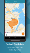
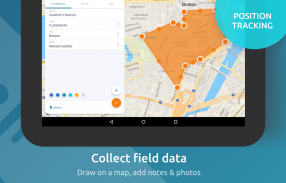
See your GPS position on your own maps. Draw points, polygons and lines on the maps. Collect field data and notes related to a location, attach a photo and fill custom properties.
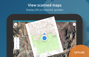
Display offline maps generated with MapTiler (https://www.maptiler.com).
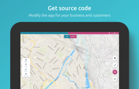
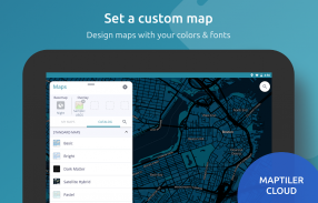
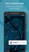
Choose from various basemaps like street and satellite. Preview on a mobile device the map you previously designed with own colors and fonts in MapTiler Cloud.
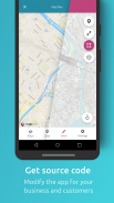
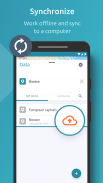
The app supports GeoJSON and MBTiles formats and data synchronization between multiple devices and desktop computer using cloud. I it easy to share the data with other people and collaborate! Perfect for mobile data collection for GIS and surveys.
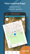
Import scanned hiking maps, PDF maps, drone aerial imagery, nautical charts for sailing and navigation with a boat or a yacht, fishing maps, aeronautical charts for flight planning by pilots, parcels and city plans and other opendata from local government. OpenStreetMap vector maps are powered by OpenMapTiles project (the successor of OSM2VectorTiles). Maps can come from existing tile servers with OGC WMTS, TileJSON or XYZ tiles from.
Supported geodata formats by MapTiler: GeoTIFF, TIFF, JPEG, ECW, SID / MrSID, NOAA KAP / BSB, DEM, OziExplorer OZI OZF2 & OZFX3, WebP, JP2, JPEG2000, GeoJP2, Erdas, Grass, Safe, Sentinel2, SRTM, NASA imagery, USGS map sheets, exports from ESRI ArcGIS, ArcSDE, etc.
The GeoJSON can be converted from / to: ESRI ShapeFile (SHP), DXF, DWG, GPX, CSV and KML.
Vedi la tua posizione GPS sulle tue mappe. Disegna punti, poligoni e linee sulle mappe. Raccogli i dati dei campi e le note relative a una posizione, allega una foto e compila le proprietà personalizzate.
Visualizza mappe offline generate con MapTiler (https://www.maptiler.com).
Scegli tra varie mappe di base come via e satellite. Visualizza l'anteprima su un dispositivo mobile della mappa precedentemente progettata con colori e caratteri propri in MapTiler Cloud.
L'app supporta i formati GeoJSON e MBTiles e la sincronizzazione dei dati tra più dispositivi e computer desktop tramite cloud. È facile condividere i dati con altre persone e collaborare! Perfetto per la raccolta di dati mobili per GIS e sondaggi.
Importa mappe escursionistiche scansionate, mappe PDF, immagini aeree di droni, carte nautiche per la navigazione e la navigazione con una barca o uno yacht, mappe di pesca, carte aeronautiche per la pianificazione dei voli da parte di piloti, pacchi e piani della città e altri opendata del governo locale. Le mappe vettoriali OpenStreetMap sono alimentate dal progetto OpenMapTiles (il successore di OSM2VectorTiles). Le mappe possono provenire da server di tessere esistenti con tessere OGC WMTS, TileJSON o XYZ.
Formati di geodati supportati da MapTiler: GeoTIFF, TIFF, JPEG, ECW, SID / MrSID, NOAA KAP / BSB, DEM, OziExplorer OZI OZF2 & OZFX3, WebP, JP2, JPEG2000, GeoJP2, Erdas, Grass, Safe, Sentinel2, SRTM, NAS immagini, fogli di mappe USGS, esportazioni da ESRI ArcGIS, ArcSDE, ecc.
Il GeoJSON può essere convertito da / a: ESRI ShapeFile (SHP), DXF, DWG, GPX, CSV e KML.
MapTiler Mobile - Versione 2.0.1
(12-03-2020)MapTiler Mobile - Informazioni APK
Versione APK: 2.0.1Pacchetto: com.maptiler.geoeditorUltima versione di MapTiler Mobile
Altre versioni


App nella stessa categoria


